
PARIS, 12-Jun-2024 — /EPR INTERNET NEWS/ — Insect outbreaks, wildfires, and windthrow are responsible for most of the biomass loss in European forests. These threats are intensified by climate change: the ever more frequent extreme weather events – like droughts, heatwaves, and storms – make trees even more vulnerable to insects and pathogens, damage and uprooting by strong winds, and to becoming dry fuel for wildfires which spread faster and burn for longer.
“The goal of the Horizon Europe SWIFTT project is to help foresters better manage their projects through affordable, simple, and effective remote sensing tools. Backed up by Copernicus’s satellite imagery and cutting-edge artificial intelligence methods, our solution provides next-generation risk modelling to ensure the longevity of this precious environmental resource in the face of climate change,” says Ariane Kaploun, Head of Nature-based Solutions at AXA Climate and SWIFTT’s project coordinator.
The European Union’s Earth observation programme Copernicus monitors our planet and its environment, providing vast amounts of data that supports applications in many non-space domains. “With Earth Observation data coming from Copernicus satellites, the SWIFTT project can contribute to the EU Forest Strategy aim of strengthening the protection, restoration, and resilience of Europe’s forests,” highlights Chiara Solimini, SWIFTT’s project officer at the European Union Agency for the Space Programme (EUSPA).
As the project reaches its halfway mark, the SWIFTT platform, alongside its web and mobile apps, is under development by our technology partners. It will provide foresters with mapping notifications of areas in their forests at risk of windthrow damage, insect outbreaks, and wildfire. Meanwhile, the research partners are working hard in the analysis of satellite imagery and the creation and improvement of the AI models that will make it possible for SWIFTT to identify those threats.
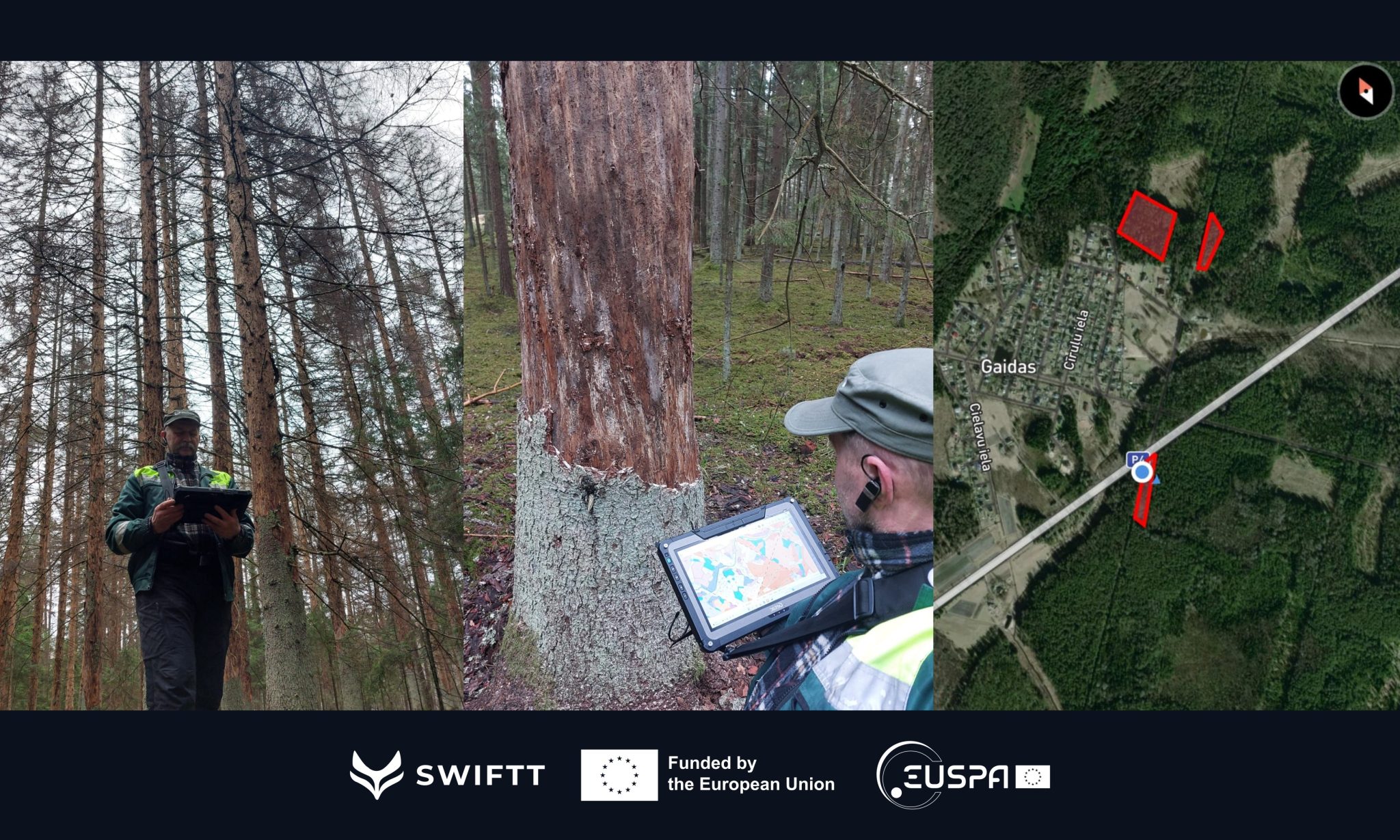
The quality of those models is largely dependent on the training data used as input. As such, SWIFTT’s end-user partners are equipped with tools working with the in-house app and global navigation satellite systems (GNSS), including the EU’s Galileo system operated by EUSPA, to collect precise, time-stamped and geo-referenced forest data sets in Belgium, France, Germany, and Latvia.
“SWIFFT is leveraging synergies among the different space components Copernicus and Galileo to address forest health threats providing an easy-to-use application to forest managers and stakeholders,” says Quentin d’Huart, CEO at project partner Timbtrack.
By combining this rich satellite data and powerful machine learning models, SWIFTT will help foresters (i) identify changes in tree health, map dieback in their forests, and coordinate sanitary cuts faster, (ii) map windthrow damage after a storm for post-storm forest management, and (iii) identify areas at high risk of wildfires. With SWIFTT’s sustainable, effective, and low-cost forest management tool, Europe will be better positioned to combat climate change and preserve our biodiversity through healthier forests.
Learn more: https://swiftt.eu/
The SWIFTT consortium is composed of AXA Climate (FR), Da Vinci Labs (FR), Groupe Coopération Forestière (FR), Leibniz University Hannover (DE), Rigas Mezi (LV), Space Research Institute of Ukraine (UA), University of Bari Aldo Moro (IT), Timbtrack (BE), and Wildsense (FR). The project has been awarded a highly competitive grant in the Horizon Europe funding programme, in the topic ‘EGNSS & Copernicus applications fostering the European Green Deal’ managed by EUSPA. The partners will receive a cumulative €2.8M grant from the EUSPA/European Commission between 2022 and 2025.
SOURCE: EuropaWire